Flood History
Stream Gage for Santa Ana River
Flood History
History of floods in San Bernardino County.
1769 to 1899
Flood history in the Santa Ana River Basin is traceable to the arrival of the Spanish Mission Fathers in the Los Angeles and San Bernardino areas between 1769 and 1776. Based upon a wide variety of diaries, special reports, court records, and writings of residents, the period from 1769 to 1859 experienced what would be referred to as eight “small” floods, seven “large” floods, and one “great” flood.
The “great” flood occurred during the 1824–25 season and was described as “probably the greatest of earlier recorded floods.” The flood of 1825 is known to have altered the course of the Santa Ana River, causing it to enter the Pacific Ocean several miles from its prior entry point.
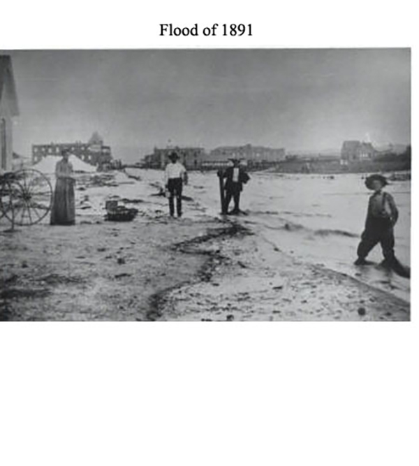
Of particular interest are the “great” floods of 1862, 1867, and 1891. In the San Bernardino Valley, the flood of 1884 approached this category
Major Floods of the 19th Century
Of all the floods, the flood of 1862 is by far the greatest on record and has been referred to as the “Noachian deluge” of California floods, during which the Santa Ana River is said to have rivaled the “Father of Waters.” Rainfall started on December 1861, and continued until January 1862, when a 24-hour downpour occurred.
It has been stated that the area from Loma Linda to the hill at Third Street and Arrowhead Avenue in San Bernardino was under water, extending for miles up and down the Santa Ana River. At Agua Mansa, below Colton, it is recorded:
“There were billows 50 feet high. The waters from the vast drainage area found themselves forced abruptly into a narrow channel, and just above Agua Mansa the river filled the valley from bluff to bluff, reaching the little church. Father Borgatta, then the pastor, heard the roar in the distance, rang the bell frantically, and the people fled to high ground. Some of the last ones had to swim.”
“In quick succession, six years later, came the “great” flood of 1867, which is reported to have approached the 1862 event in magnitude. However, it was written that: “Since the first flood had cleaned the channels, the damage done by the second storm appeared to be less.”
The season of 1883–84 is known as the wettest year of record, with San Bernardino reporting 36.5 inches of rainfall. The flood produced on March 6, 1884, though somewhat less than the 1938 event, ranks among the major floods and is referred to as the “Great Flood of Later Times.” Great damage was inflicted on newly installed railroads, and once again the course of the Santa Ana River was altered.
1900 to 1949
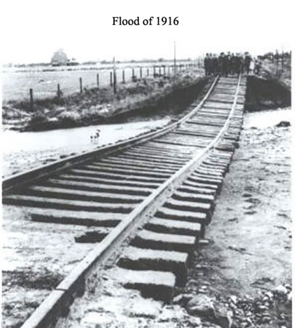
Large, though lesser, floods occurred in 1916 and 1920. Typical reports of these floods read:
“East section of city (San Bernardino) under water and in west end houses float.”
“Millions of storm damage in the southland – The entire Mexican section of East Highlands was swept away by Plunge Creek, 20 families – The Santa Ana River is now two miles wide and twenty feet deep – Disastrous flood sweeps across west end.”
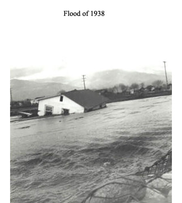
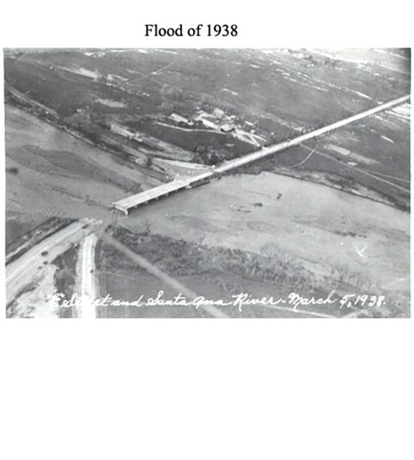
On March 2–3, 1938, the County was again swept by a “great” flood, which was the most damaging to that date due to the extent of physical property development and improvements. There were 14 known deaths in the County, with damages estimated at $12 million.
Practically no part of the San Bernardino Valley or Mojave River Valley escaped the impact of this storm. Almost every community was isolated, with roads and bridges destroyed. Hundreds of people were left homeless.
During the 31 years between 1938 and 1969, there were no “general” floods of note in the Santa Ana River Basin, except for a moderate flood in 1943, with damage primarily to Lytle Creek and the Mojave River Valley.
1950 to 1969
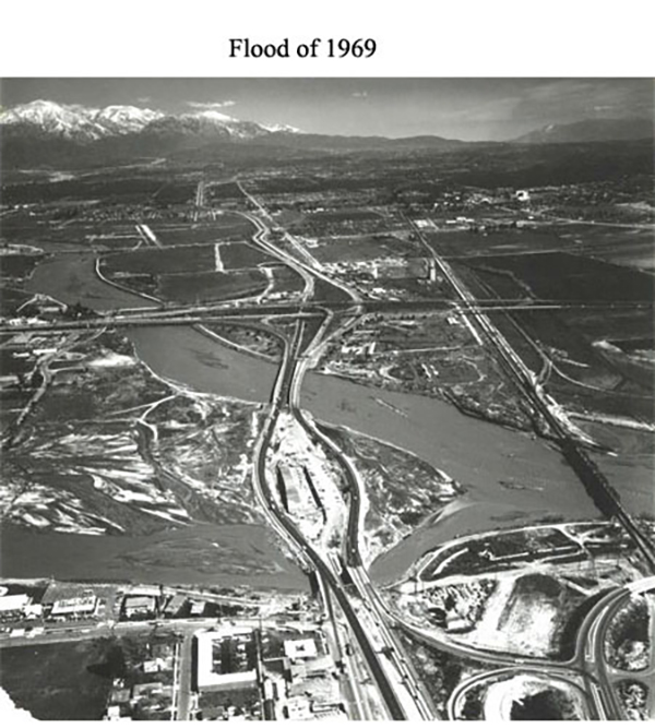
Moderate “general” floods also occurred in 1952, 1956, 1965, and 1966. Eclipsing, in many respects, the flood of 1938 were the “great” floods of January and February 1969, occurring approximately one month apart.
Rainfall intensities and amounts were greater, and, except for the Mojave River and its tributaries, runoff peaks were generally greater during the two 1969 floods.
Although flood control facilities functioned well during the January flood period, there was insufficient time to perform necessary repairs and maintenance before the late-February storm struck, which caused nearly twice as much damage.
Pecuniary losses in San Bernardino County alone from the January storm amounted to more than $23 million, and losses from the February storm exceeded $31 million. These losses represent only a portion of the damages that would have been sustained had no flood control protection been provided.
The severe flooding throughout Southern California resulted in costly damages exceeding $213 million in tangible property losses and claimed 115 lives. San Bernardino County and six neighboring counties were declared national disaster areas.
1970 to 1979
Since 1969, the flood history of San Bernardino County has remained relatively stable, with one occurrence in 1978 of a “general” storm that approached the magnitude of the 1943 and 1965 storms.
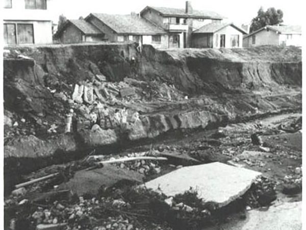
The existing flood control facilities functioned well in 1978 but sustained substantial damage from erosion and debris deposition. Total property damage from the 1978 storm is listed at $11.4 million.
There were no breakouts of flood flows; however, the earth levees of Cucamonga Channel downstream of Foothill Boulevard were critically eroded, and evacuation of a portion of the City of Rancho Cucamonga was initiated.
Construction of the Cucamonga Creek Corps of Engineers Channel was completed to Foothill Boulevard the following year. The entire project, including the tributaries Deer Creek, Demens Creek, and the San Antonio Heights Intercept, which would provide major flood protection for West End cities, was scheduled for completion in 1983.
In addition to the 1978 “general” storm, the County was affected by numerous localized high-intensity storms, particularly in 1976 in the East Desert, including Morongo, Yucca Valley, and Twentynine Palms, as well as in the City of Redlands.
In September, a thunderstorm above the Crafton Hills produced rainfall approaching four inches, with 75 to 100 percent occurring within a 30-minute period. In Redlands, water flows of up to three feet deep caused flooding in the downtown business area and more than 200 homes.
There was an estimated $1.75 million in damage: $1 million to public and private property and $750,000 to Flood Control District facilities Countywide.
1980 to 1989
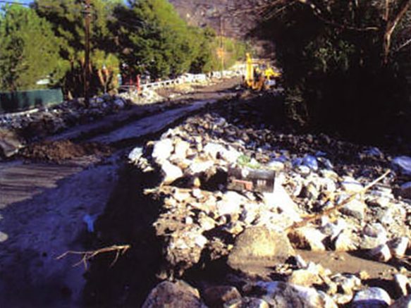
The San Bernardino Mountains were subjected to concentrated high-intensity rainfall in January and February 1980. District gauges recorded short-duration rainfall in excess of one inch per hour over the denuded watershed burned by the Daley and Shadow fires of September 1979.
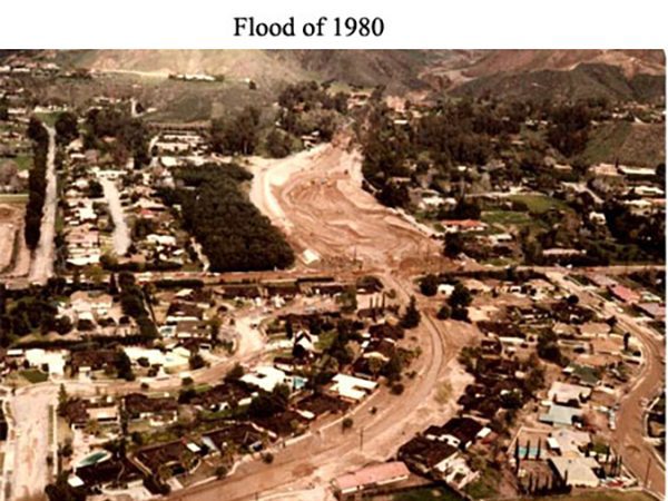
Many debris basins above the City of San Bernardino were filled with mud and debris, particularly Harrison Basin, which overflowed into the neighborhood below on four occasions, totally destroying 25 to 30 homes and severely damaging 25 more.
The February storm, which approached an overall “general” storm, caused Small Canyon Basin to overflow, pouring mud, water, and debris into houses along Small Canyon Outlet Channel and into residential areas below Highland Avenue and Mountain Shadows.
Between January and March, more than 30 inches of rain fell, causing $18 million in damage in San Bernardino County, including $8 million in damage to Flood Control District facilities
The fall of 1980 brought heavy Santa Ana winds and additional devastating watershed fires. The Panorama Fire destroyed or damaged 333 homes and burned 23,800 acres. Combined with the Baldy and other fires, more than 41,000 acres of mountain watershed were burned.
Fortunately, 1981 and 1982 were mild water years. That, combined with an extensive $5 million federally financed District basin over-excavation program, allowed the San Bernardino Valley to avoid significant additional damage.
1990 to 1999
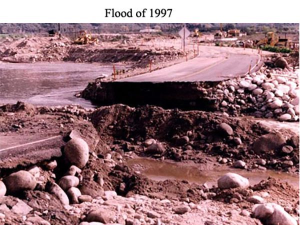
February 1998 was the most productive rainfall month during the 1997–98 winter. A total of 14.59 inches of rain was recorded for the month at the Gilbert Street gauge in San Bernardino.
The major storm event that occurred in the Valley was on February 23. The rain gauge at Gilbert Street recorded rainfall of “3–10 inches” for the day. Prior to February 23, a series of storms beginning on February 14 occurred almost back-to-back.
The storms brought light to moderate rainfall, except on February 22, when 2.18 inches of rain was recorded. Existing antecedent moisture conditions contributed significantly to the impact of the February 23 storm.
2000 to 2004
A Pacific storm system moved through Southern California on December 25–26, 2003. Heavy rain fell over much of the mountains and foothills, causing flash flooding and debris to wash across several highways and roads.
In a few locations, including Lytle Creek, rainfall rates of up to one inch per hour were recorded. Just south of Crestline, rainfall increased from 0.20 to 0.70 inches within a five-and-a-half-hour period, causing mud, water, and rockslides.
The debris flowed down into Waterman Canyon, moving through Saint Sofia Camp and killing 14 people. Continuing down Waterman Canyon, the flow destroyed two bridges and eventually fanned out, filling the basins just north of San Bernardino.
A flash flood and mudslide moved through Cable Canyon and the KOA Campground, killing two people, a bear, and a horse, and destroying 32 travel trailers, multiple vehicles, and roads.
In all, 33 of the 34 debris basins along the foothills in the San Bernardino Mountains were filled with rocks, trees, and mud.
The first major storm of 2004 occurred October 19–20. The storm was expected to produce significant rainfall intensities and large runoff due to recent watershed burns.
Fortunately, flows from the burn areas were relatively “clean,” allowing the Regional Flood Control System to handle the storm runoff generated by the event.
Any flooding experienced within the cities or developed areas resulted from debris blocking inlets and overtaxing local drainage systems.
The only noteworthy damage was the washout of a small wooden railroad bridge crossing the undeveloped portion of the San Sevaine Channel south of Whittram Avenue.
There was also a derailment involving a chlorine car and a boxcar, as well as exposure of utility lines, a 16-inch jet fuel line, and a 20-inch gas line. These impacts were caused by storm flows that collapsed the north set of railroad tracks.