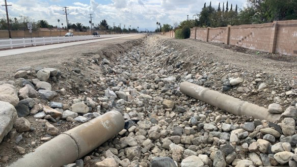
Rialto Channel is an interim earthen and rock channel located in Rialto that runs along Catus Ave, a main artery for the Rialto community. This channel accepts flows beginning from the North end of Rialto, recent commercial developments, and the 210 freeway. With the increased development over the last 10 years surrounding the area, including the 210 freeway, many of the storm flows have been localized into Rialto Channel causing maximum flows to be reached during major storms. Localized flooding has occurred during recent major storm events as a result. Several residential road culvert crossings are also affected during these peak flows. It is essential to monitor and maintain the functionality of the channel to protect the residential streets as well as Cactus Avenue. With the increased development, installation of the new Bike Trail infrastructure, and plans for additional storm drain inlets proper maintenance of the channel has become increasingly necessary and difficult.
During the February 2024 major storm event the extraordinary rain amounts inundated the Rialto area causing localized flooding and damage to Rialto Channel. As the flows subsided it became apparent there was significant debris within the invert of channel along with major erosions on the channel slopes. During our investigations it was determined that an average of 2’-3’ of excess sediment was deposited throughout the channel. This excess sediment along with the deterioration of the channel walls was significantly limiting the functionality of the channel resulting in an immediate threat to the community and roadways. With the support of our Reginal Superintendent and Management we determined that excavation of the channel and replacement of the rock armor was necessary.
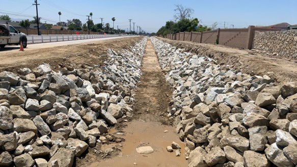
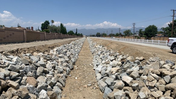
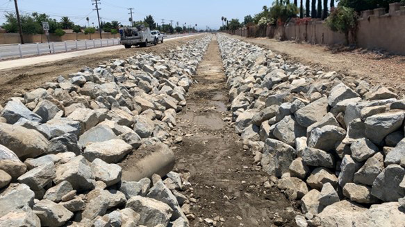
Given the infrastructure surrounding the channel and heavy community activity we focused on carefully planning logistics for the equipment, traffic control, and materials to be imported/exported. Once our plan was determined we communicated the project with City of Rialto. During this repair we utilized a nearby staging area for our materials to utilize trucks with the ability to access the channels confined access points. This enabled us to haul out the excess sediment and bring in fresh rock to armor the channel efficiently. Throughout this repair we were able to maintain the specified 10’ wide invert throughout the channel while armoring the slopes with ¼ ton angular shot rock and keeping a minimum 12’ levee top access for future monitoring and repairs. With the established RCB bridge crossings in place it was imperative to maintain the proper grade throughout the invert to ensure proper flow of the channel and to minimize future sediment buildup. This was achieved using a laser transit.
The channel repair started at the Bike Trail Bridge, south of Second St, on February 26th and was completed at Etiwanda Dr on July 26th totaling approximately 4,500 linear feet of channel. Throughout the project we exported 13,240 yards of sediment/debris and placed 12,200 tons of the ¼ ton angular shot rock. With planned additional storm drainage into the channel and Cactus Basins we are confident this repair will help maximize the channel to as-built capacity in its interim status. This repair will also allow us to reduce staffing and equipment needed to monitor the channel during heavy storms events in the future.


